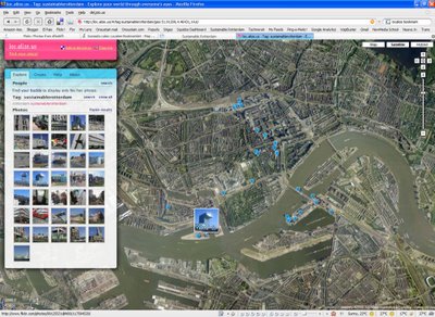
Geotagging Rotterdam
Tuesday, September 12, 2006
 I'd love to provide you a detailed review of last weekend, comprising Open Monumentendag and De Wereld van de Witte de With. However, I don't have much time for this.
Instead, you can check the pictures as you browse Rotterdam at Google Maps. For a while, I've been geotagging all the pictures at Flickr with loc.alize.us; a simple to use tool to geotag and display pictures from Flick.
Want to contribute with your own pictures? Use loc.alize.us, geotag them, add "sustainablerotterdam" tag. Let's cover the map!
Note: Flickr just released an integrated geotagging service, however I personally find that the quality of its satellite pictures makes it difficult to define the exact location. In addition, loc.alize.us looks really neat.
Related Posts:
1 Comments:
commented by  Anonymous, 4:55 PM
 Anonymous, 4:55 PM


Eduardo